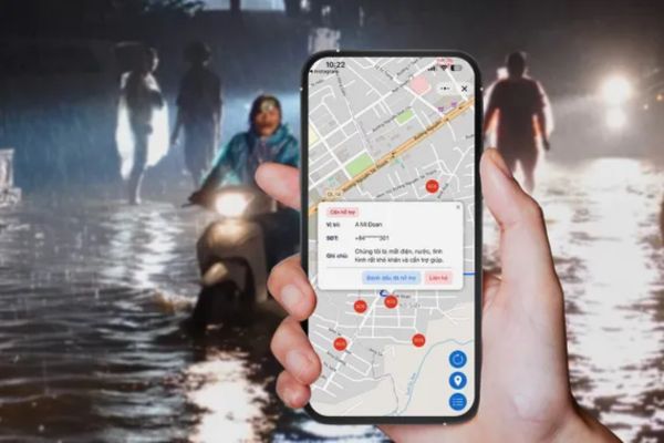
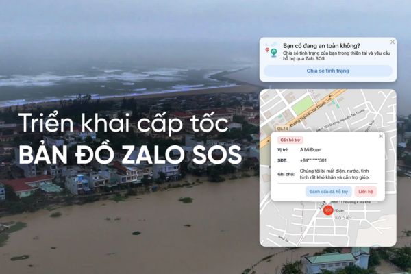
Job Send a distress signal using Zalo is becoming an essential digital survival skill in the increasingly complicated situation of floods. The newly updated SOS map feature not only helps people instantly connect with rescue teams but also supports accurate positioning of rescue locations in real time.
| Join the channel Telegram belong to AnonyViet 👉 Link 👈 |
Operational mechanism of the Zalo SOS rescue map
In the face of unpredictable floods and rains, technology has been thoroughly applied to support search and rescue work. The SOS map feature works on data visualization, helping stakeholders easily grasp the actual situation on the ground.
Classify rescue status on the map
The system is designed to display information in the most intuitive way through color coding, helping viewers clearly distinguish between emergencies and safe places. The system will automatically put people’s location information on the map in the form red dot as soon as the request is sent, signaling that this is a hot spot that needs urgent help. Cases that have received timely support will have their display status changed to greenhelps mark areas that have been processed.

Resource optimization and local coordination
Not only does it show the location, the map also plays an important role in coordinating forces to avoid wasting the efforts of relief teams. The map supports data filtering by specific localities, helping authorities easily localize and coordinate on-site rescue teams quickly. This approach significantly shortens the time it takes to get to the scene and minimizes duplication of resources, ensuring help reaches as many people as possible.

Instructions on the process of sending a distress signal using Zalo
To ensure information reaches rescue forces accurately and quickly, people need to perform the correct operations on the application.
Step 1: User open Zalo applicationaccess features Zalo SOS and proceed to send a rescue request with important information such as location, detailed description of current condition and necessary material needs.
Step 2: Immediately after sending, the system will automatically put this request on the public map, displayed as a red dot at the exact coordinates of the sender’s location to warn.
Step 3: Authorities and the surrounding community will monitor the map and use local filters to identify red alert points closest to their area to plan their approach.
Step 4: When the relief work is completed, rescue participants or people need to confirm on the system again to change the status from red to green, signaling the end of the mission.

Conclusion
The birth of the SOS map is a remarkable and helpful effort Send a distress signal using Zalo become more effective and practical than ever. Hopefully, with the above specific instructions, people in flood areas will have an effective tool to protect themselves and their families. Please proactively update this feature to help the community and authorities get through the stormy season in the safest way.


