
Fly a plane on Google Earth is a completely new experience that the technology giant has just quietly added. You don’t need to download heavy games but you can still enjoy sightseeing around the world right on your browser. So how to activate this interesting feature? Let’s explore with AnonyViet in the article below!
📢 Join the channel Telegram belong to AnonyViet
Update new articles, cool tools and IT tips fastest
What’s interesting about the experience of flying a plane on Google Earth?
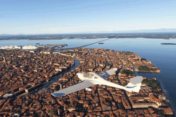
Recently, Google brought a big surprise by integrating an extremely cool feature, turning your regular web browser into a miniature “flight simulator”. Although not born to compete with blockbuster professional aviation games, this is truly a great gift for those who like to explore the world in a new way.
Specifically, Google has cleverly embedded the flight simulator mode directly into its web version. Thanks to that, you do not need to bother downloading any software, nor do you need to buy a high-configuration computer. This feature is designed primarily for the purpose of “entertainment exploration”. Instead of having to memorize complicated aviation theory or having to worry about precise takeoff and landing buttons, you just need to choose a favorite coordinate on the map and start wandering around admiring the scenery.
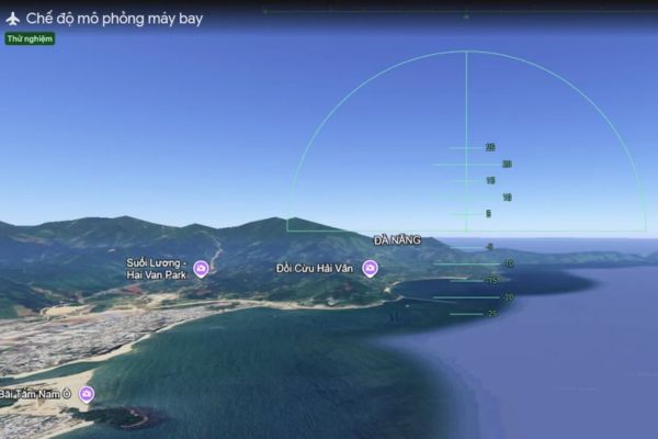
The biggest selling point of this experience is the massive image data warehouse. As you fly over megacities, 3D buildings and high-resolution landscapes are continuously downloaded in real time. The feeling is really vivid, just like you are sitting in a real helicopter.
Instructions for flying a plane on Google Earth
If you are eager to try your hand at being a pilot, here are the operations you need to understand. Enabling this feature is extremely simple and quick.
Step 1: Open your web browser and access it Google Earth homepage on your computer.
Step 2: Right at the main screen interface, move your eyes up and click on the item Explore Earth.
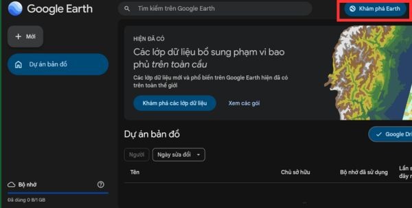
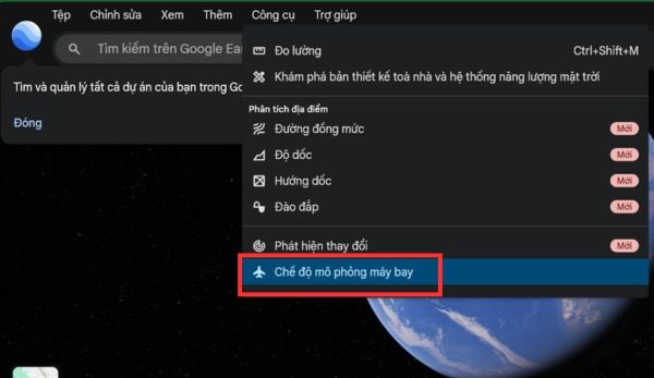
Step 3: Next, you find and open the menu Toolsselect Flight simulation mode in the drop-down list to officially start your aerial journey.
How to control when flying in the sky
After entering the virtual cockpit, the next step you need to get familiar with is the controls. To make the process of flying a plane on Google Earth go smoothly, the system allows you to use extremely convenient keyboard shortcuts right on your computer keyboard.
| Action you want to perform | Corresponding key press | Specific functions |
| Increase thrust | Page Up key (or click on the indicator) | Increase aircraft engine speed |
| Reduce thrust | Page Down key (or click on the indicator) | Reduce aircraft engine speed |
| Increase altitude | Up arrow key (↑) | Point the nose of the plane up to fly higher |
| Reduce altitude | Down arrow key (↓) | Point the nose of the plane down to lower altitude |
| Tilt left | Left arrow key (←) | Tilt the plane left to turn left |
| Tilt right | Right arrow key (→) | Tilt the plane to the right to turn right |
| Change control mode | Click on the flight area | Alternate between using the mouse and keyboard |
Of course, for those who are new to flying, accidentally causing the plane to crash into the ground or into a cliff is very normal. When a collision occurs, the simulation mode will automatically pause.
Then, you just need to click the button “You crashed! Restart“(You have crashed! Restart) appears on the screen. Immediately, the system will return your aircraft to a safe position in the air to continue the flight without having to start from the beginning.
Additionally, if you want to end the flight, exiting is also extremely simple. Please click on the icon back arrow (←) in the upper left corner of the screen. Therefore, the system will close the simulation mode and return you to the familiar map interface.
The truth about satellite images as you sightsee
There is a question that many users often ask: Is what we see when flying a plane on Google Earth a live image at that moment? The answer is absolutely not!
In fact, the images you are looking at are a collection of many satellite images and aerial photos taken at different times, then stitched together by a computer. Depending on the location, the image may have been taken just a few months ago, or it could be several years old. For most urban areas, images are typically updated more frequently (sometimes annually), while remote areas may remain unchanged for long periods of time.

Conclusion
In short, work fly a plane on Google Earth is an extremely effective and enjoyable way to relieve stress. You don’t need to go far to still be able to see the vast world right through your computer screen. Hope you have fun and memorable virtual flights!
Frequently Asked Questions (Q&A)
1. Can this flight simulation mode be used on phones?
According to information from Google, currently this feature is only for sightseeing purposes and users can only experience it on the web version of Google Earth for computers.
2. Why don’t I see 3D buildings appear when flying?
By default, flight mode will display a simple map (Map). You need to change the map type to Satellite and make sure the Internet is strong enough for the 3D images to have time to fully load.
3. Is the image I see while flying live?
No, Google Earth is not a live streaming service. The images you see are satellite images taken at different times (months or years ago) and stitched together by the system.